Project Description
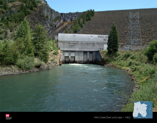
Hills Creek Dam is located on the Middle Fork of the Willamette River three miles upstream of Oakridge and 42 miles upstream of Eugene and Springfield, Oregon. Hills Creek Dam is a 304-foot tall, 1,920-foot long rockfill earthen embankment dam with a concrete spillway, three spillway gates, an intake structure with regulating outlet, and a powerhouse. Hills Creek dam is owned, operated, and maintained by the U.S. Army Corps of Engineers (USACE). Construction of the dam began in 1956 and was completed in 1961. Hills Creek is part of a system of 13 multi-purpose dams in the Willamette Valley with the primary purpose of flood risk management and secondary purposes of hydropower, recreation, irrigation, municipal and industrial water supply, fish and wildlife, and water quality. Collectively, this system of dams is referred to as the Willamette Valley Project.
During the winter months, the reservoirs are maintained at their lowest elevations to allow for the temporary storage of rain and snowmelt. When managing high flow events, the outflow from the system of dams is coordinated to reduce peak flows and river stages at downstream locations. In spring, USACE begins to fill the reservoirs, increasing the amount stored for conservation purposes and reducing the amount available for flood risk management. During summer, stored water is used for recreation on the reservoirs, and some stored water is released in the river downstream to improve water quality, produce hydropower, support fish and wildlife habitat, and provide water for irrigation and municipal uses. During dry summer months, flows into the reservoirs are generally less than flows needed to meet minimum flow objectives, causing reservoir levels to drop. In fall, stored water remaining in the reservoir is drawn down to minimum levels in preparation for the flood season. Hills Creek is upstream of Lookout Point Dam and Dexter Dam.
Hills Creek Dam is located about 90 miles east of the Cascadia Subduction Zone, a megathrust fault along the Oregon Coast. The Cascadia Subduction Zone can produce very large, long duration earthquakes. The last Cascadia Subduction Zone earthquake occurred in the year 1700.
Risk Characterization: High
USACE has been conducting advanced risk assessments, called Issue Evaluation Studies (IES), at several Willamette Valley Project dams including Hills Creek Dam. As of April 2019, results of the IES for Hills Creek Dam identified the risk associated with the dam to be High.
USACE preforms risk assessments as part of an ongoing dam safety program and to assist in the prioritization of investment for aging infrastructure. The risk assessments evaluate the life safety risks associated with the dams to determine if risk reduction actions are needed and, if so, what actions should be taken. The assessments consider a wide range of hazard scenarios from the most likely to the most extreme and unlikely. The risk is driven by two factors: the high population downstream combined with the potential for an extreme earthquake occurring at the same time reservoir elevations are the highest. According to the IES, an extreme earthquake could cause the earthen dam to settle, resulting in water overtopping the dam. It is difficult to predict the exact amount of settlement that could occur to the dam as a result of such an earthquake. The speed and depth of water overtopping a damaged dam could erode the soil and rock that forms the dam and cause significant flooding downstream. Because Hills Creek Dam is located upstream of Oakridge, Lowell, Jasper, Eugene, and Springfield Oregon, there is potential for devastating flooding to affect large downstream populations in urban areas and surrounding suburbs, as well as rural communities in the floodplain and narrow canyons.
USACE is confident that the Willamette Valley dams are well-built, well-maintained, and will continue to significantly reduce flood risks for the region. However, the dams cannot eliminate potential for flooding. Even with the presence of the Willamette Valley dams, extreme rainfall and snowmelt events may result in flooding in areas downstream of dams. Flooding can be caused by high flows resulting from unregulated portions of the watershed and/or high flow that must be passed through the dam outlets and spillways when reservoir storage capacities are exceeded.
Risk Management Measures
The likelihood is very low for an extreme earthquake to occur, but the potential impacts of a dam failure are very high due to the large downstream population. Therefore, immediate action is warranted to reduce risk to acceptable levels. Targeted measures (called Interim Risk Reduction Measures) were implemented in spring 2020 to reduce life-safety risk while issues identified in the Study are evaluated further. These measures include reducing the maximum conservation pool (the highest allowable level during summer) of Hills Creek reservoir by 10 feet. USACE continues to evaluate the seismic performance of the embankment to determine if long-term modifications will be necessary. USACE regularly conducts routine inspections of its dams and Hills Creek Dam is equipped with instrumentation to monitor dam performance and seismic activity. Post-earthquake procedures are in place to inspect and evaluate earthquake damages and USACE conducts routine dam safety exercises with local Emergency Managers and first responders. Hills Creek Dam’s Emergency Action Plan (EAP) outlines actions to be taken during an emergency. USACE will update the EAP based on recent risk assessment results and information from updated inundation maps. In addition, USACE will continue and increase its outreach to improve community awareness of flood risks and risks associated with the dam.
View more details about Hills Creek Dam at the National Inventory of Dams website.