Building Strong® at Westport Slough

Westport Slough, as shown by Google Earth Pro
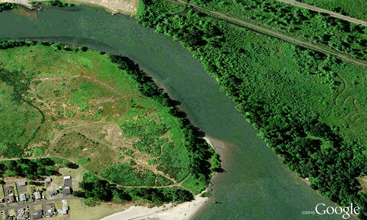
The Westport Slough channel is authorized to 28 feet deep and 200 feet wide, from deep water in the Columbia River into Westport Slough to the ferry dolphin at Westport, Ore. The project is across from the Wahkiakum Ferry channel in Washington.


Until recently, the navigation channel was maintained to a 9-foot depth, adequate for the Wahkiakum Ferry, a vital interstate transportation link for the entire Lower Columbia region. The ferry runs between Cathlamet in Wahkiakum County, Wash. and Westport in Clatsop County, Ore. The ferry carries more than 50,000 vehicles each year; it's not only the most energy-efficient local travel option, it also provides a critical alternative route for interstate traffic when the nearest bridges (26 miles upstream or 43 miles downstream) or highways are closed by weather, traffic accidents, or other causes.


Wahkiakum County completed a $2.8 million ferry terminal upgrade investment in 2010, and plans to put a new, larger $3.9 million ferry vessel into service in 2014. Clatsop County plans $2.4 million in improvements to the ferry landing at Westport to accommodate the new ferry. Federal and State funds are contributing to these investments. The new ferry will have double the capacity for vehicles, and its larger deck will hold tour buses and trucks.


The return of ocean-going deep draft barge traffic to Westport Slough channel now requires increased dredging to maintain a 20-foot depth.

For more information

Contact us:

Phone: 503-808-4510

Email us about the Westport Slough

Latest News Releases

Road NF-1993 across Cougar Dam closed for construction
3/13/2024
The U.S. Army Corps of Engineers (USACE) will close both lanes of Road NF-1993 across Cougar Dam, Mar. 18 from 7:00 a.m. to 5:00 p.m...
Columbia River locks shut down for annual maintenance
2/1/2024
The $23 billion of commerce that flows along the Columbia River will pause for two weeks beginning March 2 as the U.S. Army Corps of Engineers (USACE), Portland District closes three navigation locks...
The Dalles Dam Hosts 14th Annual Eagle Watch
1/17/2024
The Dalles Dam invites the public to their 14th annual Eagle Watch event on Jan. 27 from 10 a.m. to 3 p.m. During the month of January, The Dalles Dam Visitor Center will be open every Tuesday through...

Operations: Westport Slough

Collapse All Expand All
 General information

The vertical plane of reference is adopted low water. The project is subject to tidal influences and annual river freshets. A large shoal regularly forms at the mouth of Westport Slough (where the slough empties into the Columbia River), requiring dredging by a contract clamshell dredge every 2 to 3 years for adequate depth to allow ferry passage. It was last dredged in early 2010; the material was placed at an in-water site. The remainder of the channel shoals more slowly, but may need additional dredging to maintain adequate depth for ocean-going deep draft barge traffic. A clamshell dredge is needed to clear the channel to 20 feet for barge traffic, with dredged material placed at an in-water or an upland site.

Limited advanced maintenance width dredging outside the authorized channel width and up to 2 feet of advanced maintenance dredging below the authorized channel depth is practiced in order to maintain adequate depth for the users between dredging events.

 Project description
Authorized channel 28 feet deep and 200 feet wide, from deep water in the Columbia River at Columbia River Mile 43, into Westport Slough to the ferry dolphin at Westport, Ore.
 Authorization
The Rivers and Harbors Act of August 26, 1937.