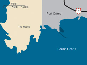
Port Orford is on Oregon's coast, 250 miles south of the Columbia River and 390 miles north of San Francisco Bay.
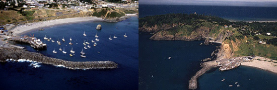
The project consists of a 550-foot extension of a locally-constructed breakwater and a 16-foot-deep mooring basin. Construction of the extension was completed in 1968 and of the mooring basin in 1971. The project authorization was modified by the Water Resources Development Act of 1992 to allow the Corps to maintain the authorized navigation channel within 50 feet of the port facility.
The Corps of Engineers does not maintain recreation facilities at this location. Please stay off the jetties as they are hazardous and not intended for recreational use. Nearby recreational facilities fall under the jurisdiction of private, local or state agencies.
Port Orford's Facilities
Facilities at Port Orford includes almost three acres of dock area and two large-capacity hydraulic cranes for lifting boats from the water for repairs and/or storage and removing fish catches from boats. In fiscal year 2000 local sponsors replaced the aging wooden pile dock with a sheet pile bulkhead and backfill dock. About 150 fishing and private boats use the dock each year.
Project Description
The turning basin at Port Orford is 340 feet long, 100 feet wide, and 16 feet deep.
The extension to locally constructed breakwater is 550 feet long.
Authorization
The Rivers and Harbors Acts of: Oct. 27, 1965, and Dec. 31, 1970.
The project authorization was modified by the Water Resources Development Act of 1992.